Flinder Ranges & Outback
Back to list | 138 views
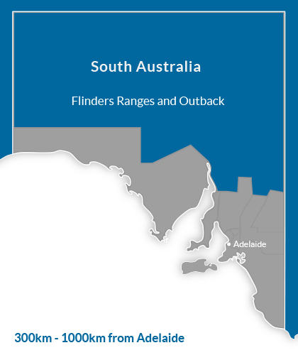
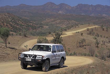
ABOUT THIS REGION Flinders Ranges is the largest mountain range in South Australia, which starts approximately 366 km (227 mi) north of Adelaide. The discontinuous ranges stretch for over 430 km (270 mi) from Port Pirie to Lake Callabonna. Its most characteristic landmark is Wilpena Pound, a large, sickle-shaped, natural amphitheatre covering nearly 80 square kilometres (31 sq mi), containing the range's highest peak, St Mary Peak (1,170 m (3,840 ft)) and adjoining the Flinders Ranges National Park. The northern ranges host the Arkaroola wilderness sanctuary and the Vulkathunha-Gammon Ranges National Park. The southern part of the ranges are notable for the Pichi Richi scenic railway and Mount Remarkable National Park. The Arkaroola Wilderness Sanctuary is a scenic protected area at the northern end of the ranges. In addition, the Dutchman's Stern Conservation Park, west of Quorn and the Mount Brown Conservation Park, south of Quorn, are protected areas of the ranges. The Heysen Trail and Mawson Trail run for several hundred kilometres along the ranges providing scenic long distance routes for walkers, cyclists and horse-riders. Outback South Australia is where you’ll find Australians who live hundreds of kilometres from their nearest neighbour. They wait for the twice-weekly delivery of mail and goods from the outside world, brought by a postman and the few lucky tourists accompanying them. There are magnificent mountains, glowing red in the sunset, with caps of lichen covered rocks and razored edges. Feel part of nature with emus and kangaroos passing by your campsite. Experience the peace and darkness at night in the bush. The region has a semi-arid climate with hot dry summers and cool winters. Summers usually have temperatures reaching over 38C, while winters have highs around 13C-16C, depending on the elevation. Although rainfall is erratic, most of the precipitation is seen in the winter months. There are also some monsoonal rains that come from the north in the summer. INDUSTRY RESOURCES Regional Tourism Website : Flinders Ranges Regional Tourism Website : Southern Flinders Ranges Regional Tourism Website : South Australia Research and Statistics : South Australian Tourism Commission Local Councils : Local Government Association of SA CREDITS Information Source : Wikipedia Information Source : South Australia Image Credit : Bunyeroo Valley, Flinders Ranges National Park : SATC : Neale Winter Regional Map : Copyright 2014 GoPanda Communications GoPanda

